Surveyors on construction sites, cadastral engineers, and even unmanned tractors all need GPS coordinates with centimeter accuracy. Standard GPS gives you maybe 2-3 meters — useless for precision work. NtripCaster is a server that streams correction data from base stations to rovers in the field, making centimeter-level positioning possible.
How NTRIP works
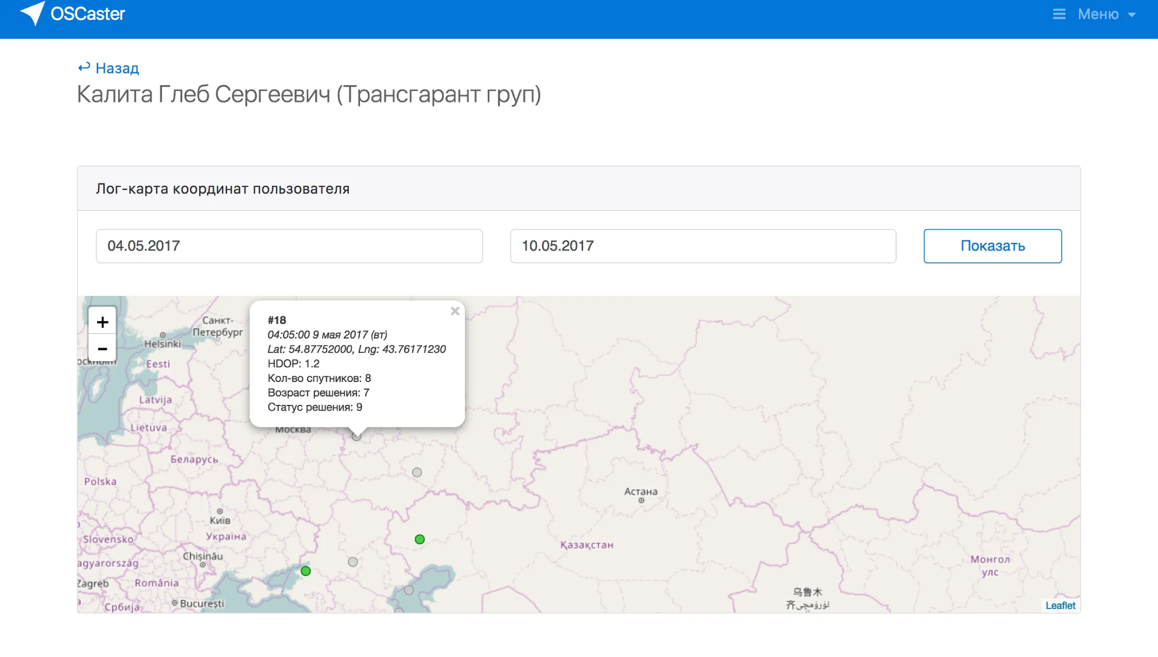
There are fixed base stations with known coordinates. They compare their known position to what the GPS satellites report and compute the error. NtripCaster collects these corrections and streams them in real time to any device in the field that connects via the NTRIP protocol.
The result: a surveyor's receiver goes from 2-meter accuracy to 2-centimeter accuracy. That's the difference between "somewhere in this parking lot" and "this exact bolt on this exact pipe."
What I built
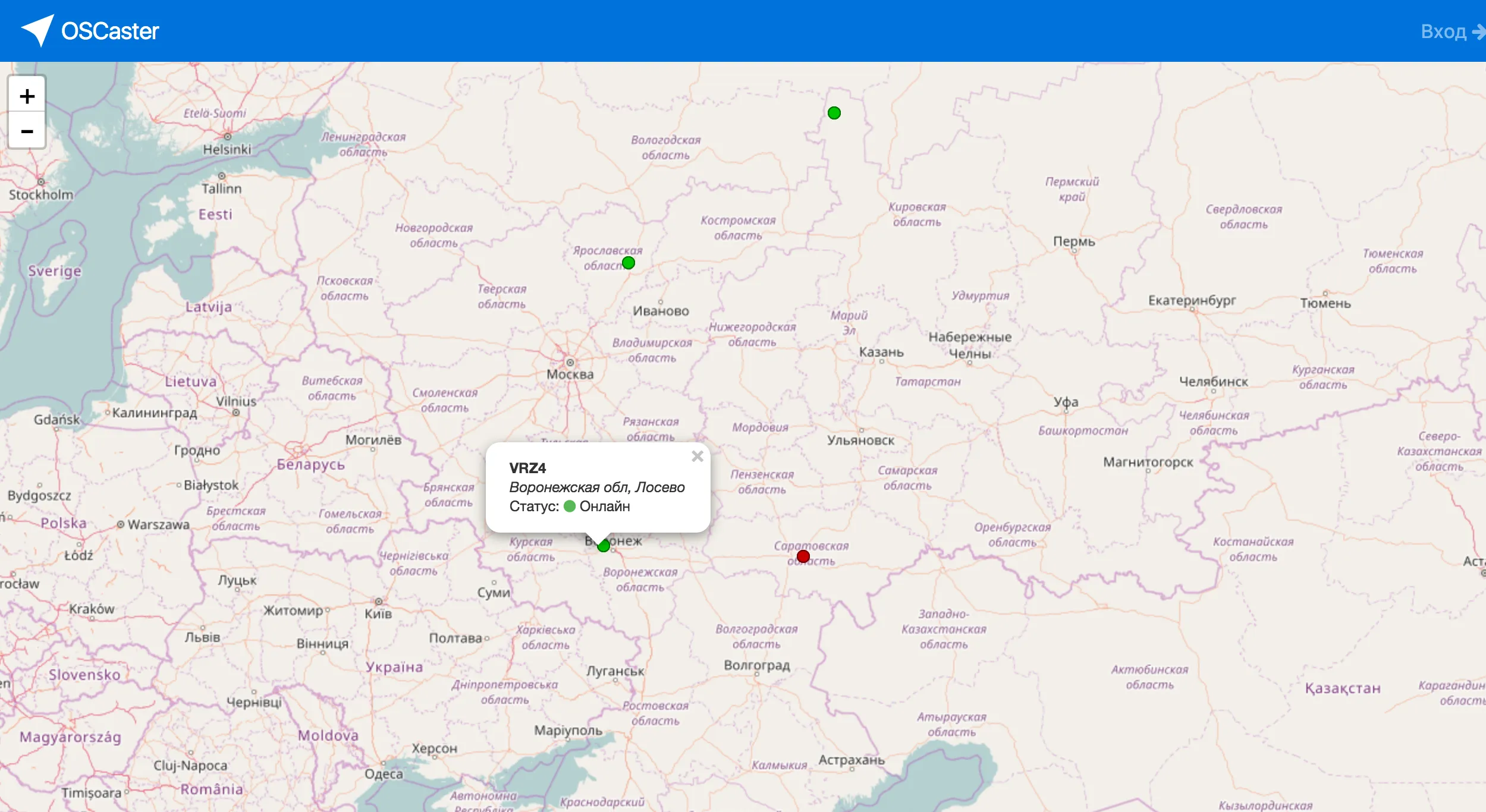
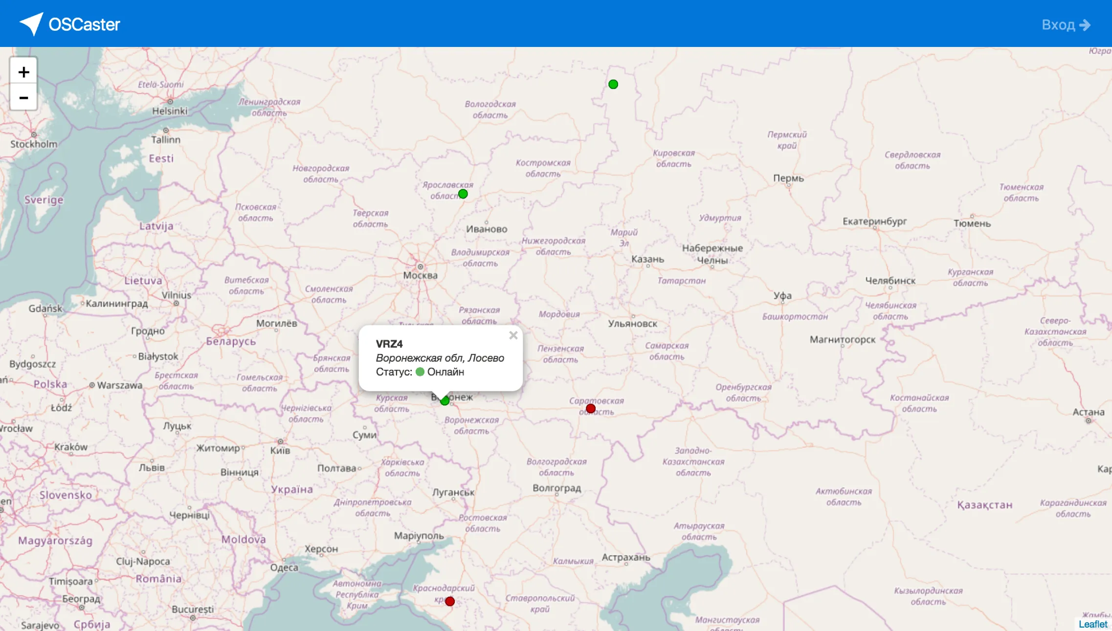
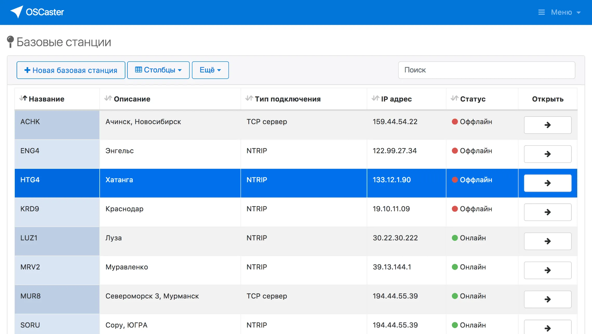
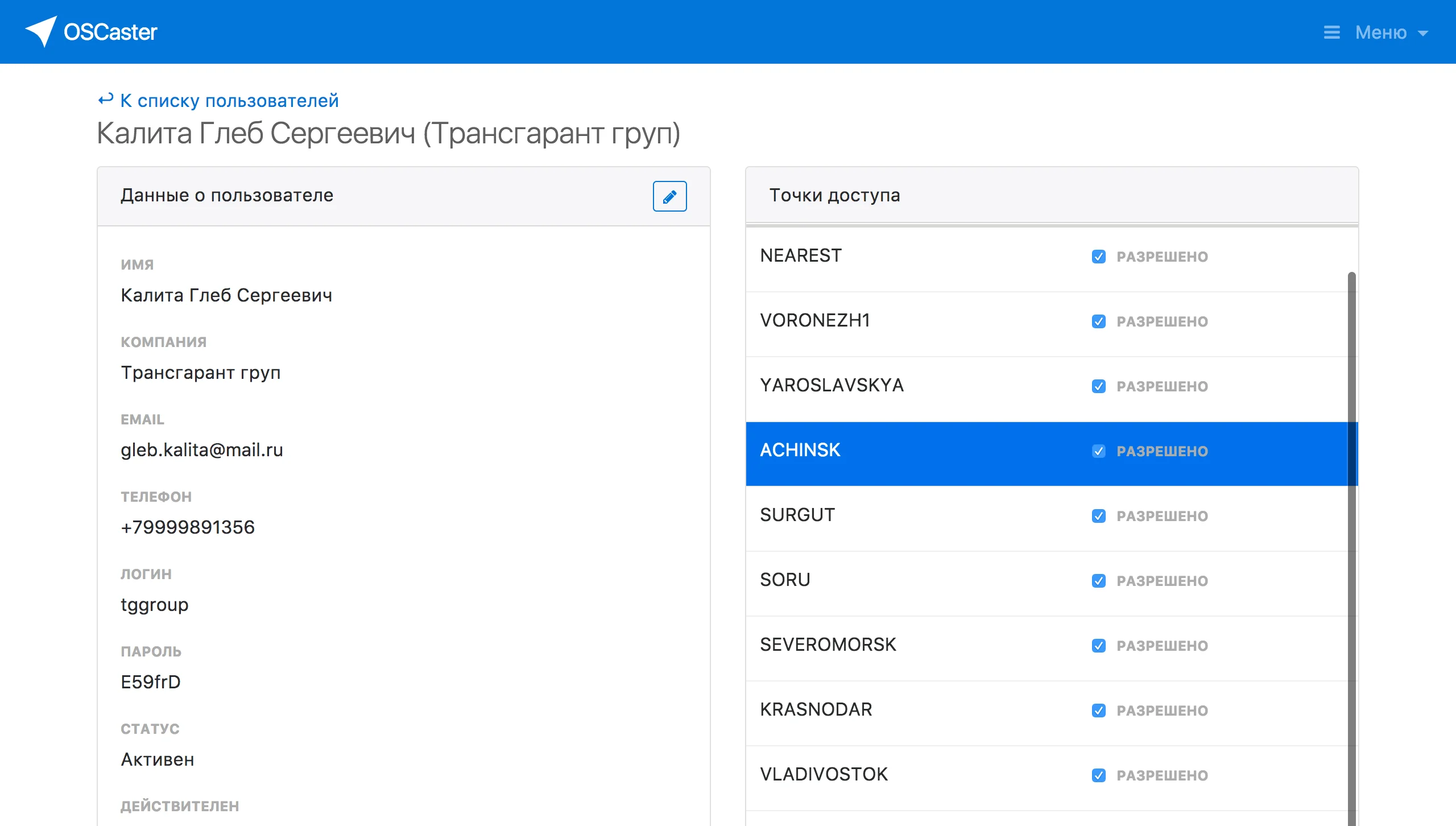
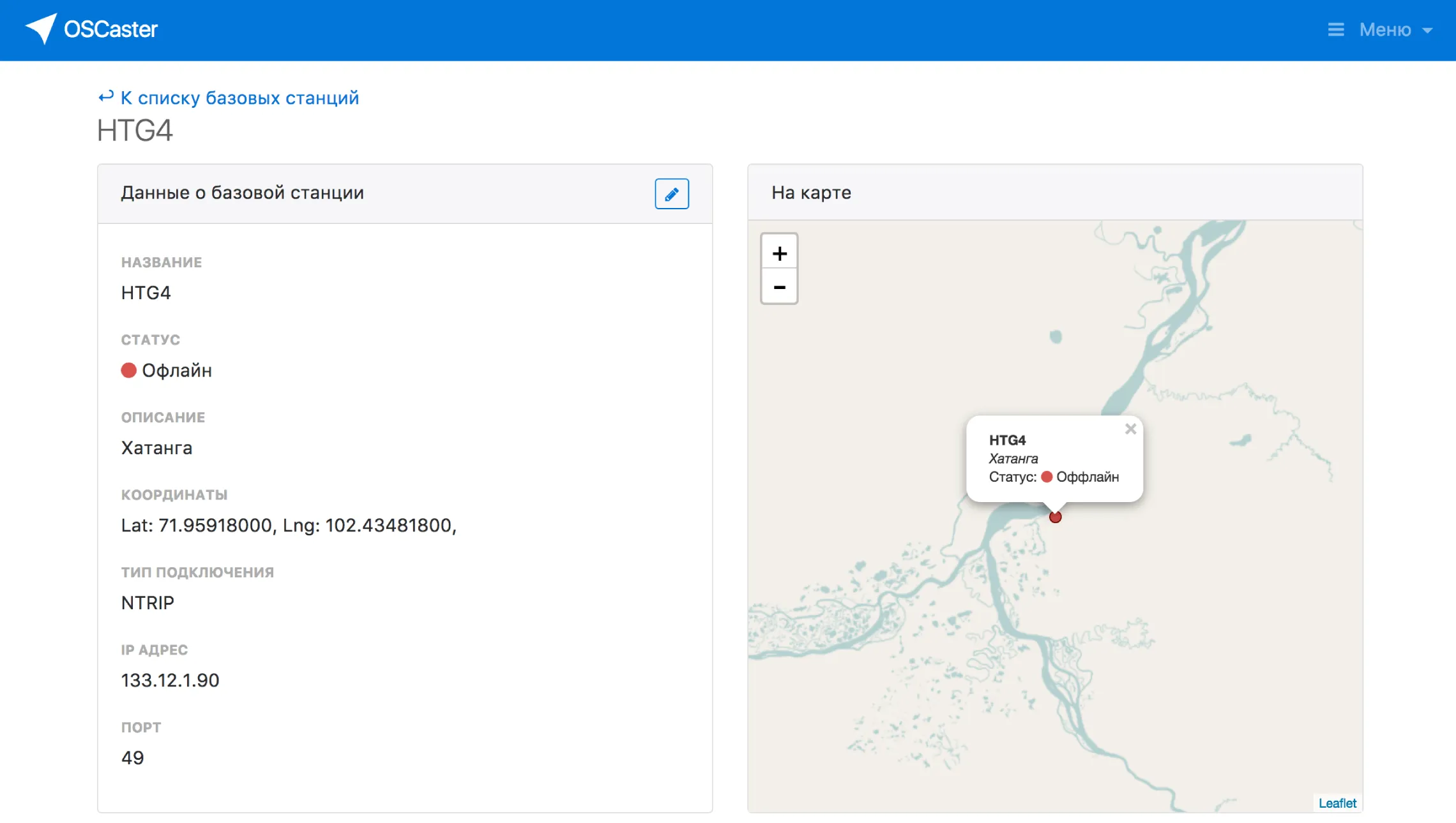
The server handles multiple base stations, manages user authentication, monitors connection quality, and streams correction data with minimal latency. The admin panel shows who's connected, data throughput per station, and system health.
The protocol itself (NTRIP) is a standard in the geodesy world — basically HTTP streaming with a specific binary payload. The challenge was making it reliable and fast enough for real-time field work where every millisecond of delay means reduced accuracy.